top of page
European Immigration Interaction and Perception
Spring 2024
River Falls, WI
ArcGIS Pro


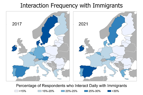

This set of choropleth maps of Europe was created in Spring 2024 for my Geography Senior Seminar course (GEOG 401). These maps show the percentage of respondents who view immigration as a problem and opportunity, interact with immigrants never and daily, and the total amount of immigrants for 2017 and 2021 using data from the Eurobarometer and Eurostat.
This project was featured at the 2024 Midwest Undergraduate Geography Conference and the University of Wisconsin - River Falls 2024 Undergraduate Research, Scholarly, and Creative Activity Gala.
bottom of page